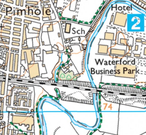
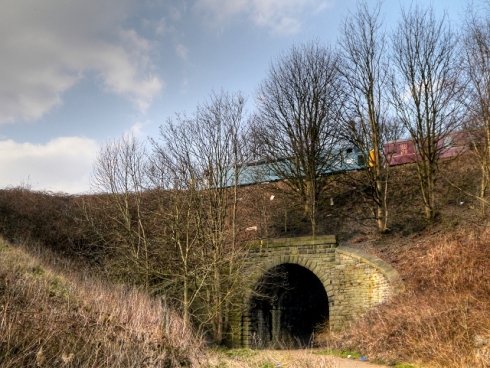
As part of our Government-authorised daily exercise, I’ve been doing a walking loop from our house near Pimhole, down to the River Roch, over the footbridge on the way to Asda Pilsworth, then back past the Village Hotel and home. I don’t care for walking down the same path over and over again: I’m an explorer. I want to walk along all the footpaths on the map, see where they go, how they connect up, possibly which ones to avoid in future. But needs must. It’s quite a nice little walk, past the community farm and under the railway, with the sound of running water coming from a little stream to the side of the footpath.
But hearing a babbling brook, I needed to know a bit more about it. There aren’t any brooks I can recall in Bury town centre, but the water must come from somewhere. Is there a hidden culvert running under Bury, with a stream running along it? It’s happened elsewhere, such as the Tib and Medlock in Manchester city centre.
My usual go-to source is the OS layer on Bing Maps – but the water appears without name, its source seemingly a few hundred metres away from the Roch. That can’t be right. Looks like some more cyber-sleuthing is required…